Understanding map radius distance is essential for a multitude of applications across the United States. This guide explains how to accurately calculate and utilize a map radius, empowering U.S. searchers with valuable insights. Whether you are a business owner looking to define your local service area, a real estate agent identifying properties near specific amenities, or an individual planning an event, knowing how to measure distances on a map can significantly enhance your decision-making process. We delve into various free and paid online tools that simplify this process, offering step-by-step instructions. Discover why a precise radius calculation is vital for local SEO strategies, optimizing delivery routes, or simply finding the nearest attractions. This comprehensive overview helps you navigate mapping applications with confidence, allowing you to compare locations, assess reach, and take informed action for your specific needs, making your planning more efficient and effective in 2026 and beyond.
- What is a map radius? - A map radius is a precise circular area around a central point on a map, defined by a specific distance. It measures the straight-line distance from the center to any edge of the circle, helping visualize geographical proximity for various applications.
- How do I create a radius on Google Maps? - While Google Maps lacks a direct radius drawing tool, you can use external websites like FreeMapTools or Map Developers. These tools integrate Google Maps, allowing you to click a point, enter a distance, and visualize the radius directly on the map interface.
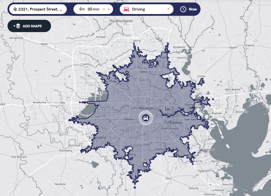
- Can I find a radius by driving time instead of distance? - Yes, some advanced mapping tools and specialized calculators offer 'drive time' or 'isochrone' radius features. These tools generate irregular shapes representing areas reachable within a specific travel time, accounting for roads and traffic, rather than just straight-line distance.
- Why is map radius crucial for local businesses? - Map radius is crucial for local businesses to define clear service areas, optimize delivery routes, and target local marketing effectively. It helps them understand their operational reach, manage customer expectations, and respond to 'near me' searches, enhancing overall efficiency and customer satisfaction.
- Are there free tools to calculate map radius? - Absolutely, many free online tools are available for calculating map radius. Popular options include FreeMapTools, CalcMaps, and Map Developers. These websites provide user-friendly interfaces where you can easily input a central location and specify a radius to visualize on a map.
- How does map radius help with real estate searches? - Map radius significantly aids real estate searches by allowing buyers to find properties within a specific distance from schools, workplaces, or amenities. It helps visualize commute times, assess neighborhood walkability, and ensure properties meet proximity requirements, streamlining the decision-making process for homes.
- What are the best uses for a map radius tool? - The best uses for a map radius tool include defining business service areas, planning local deliveries, finding properties near specific points of interest, optimizing event locations for attendee travel, and personal exploration of attractions within a certain distance from your home.
How do you draw a radius on a map?
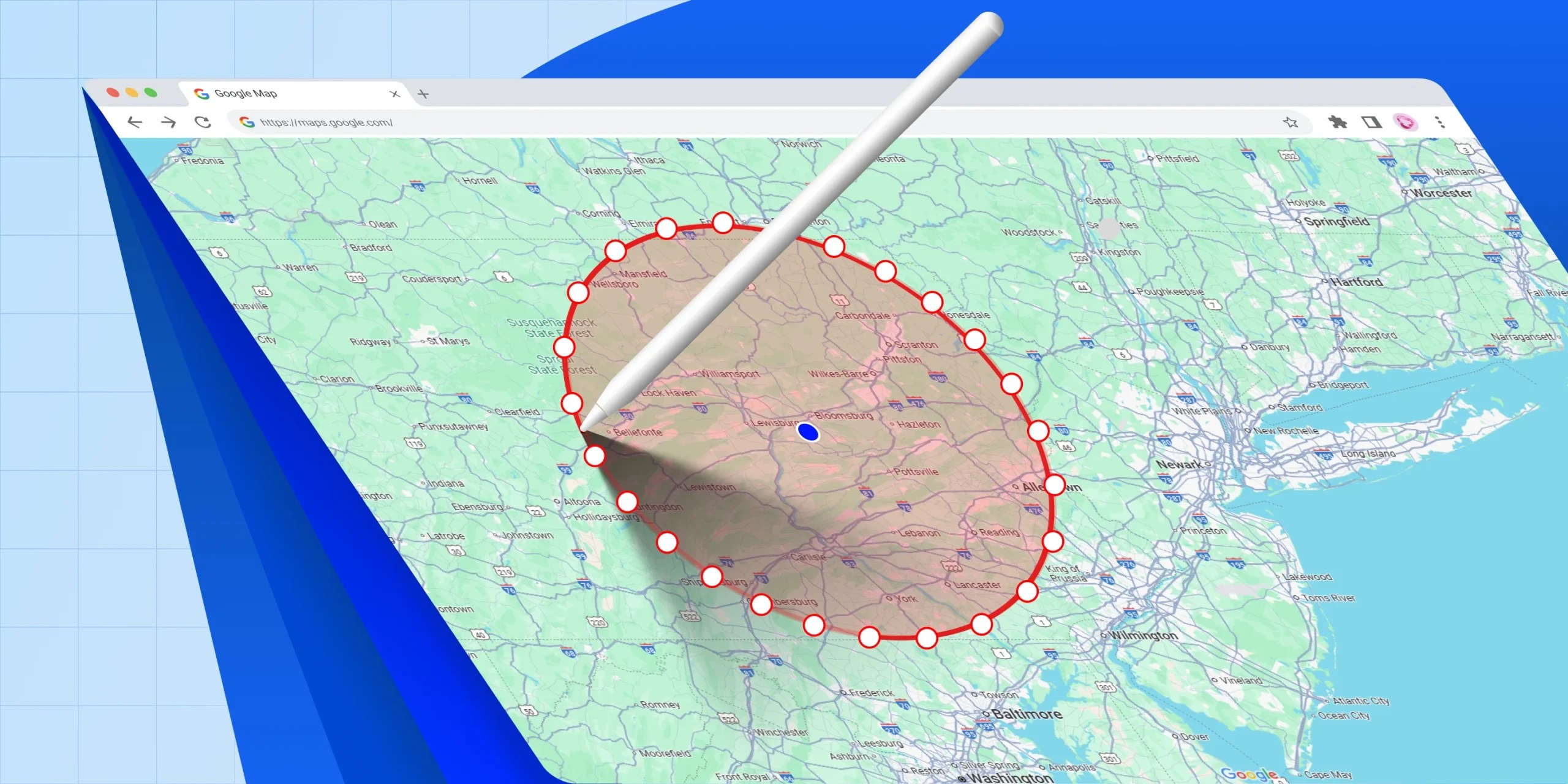
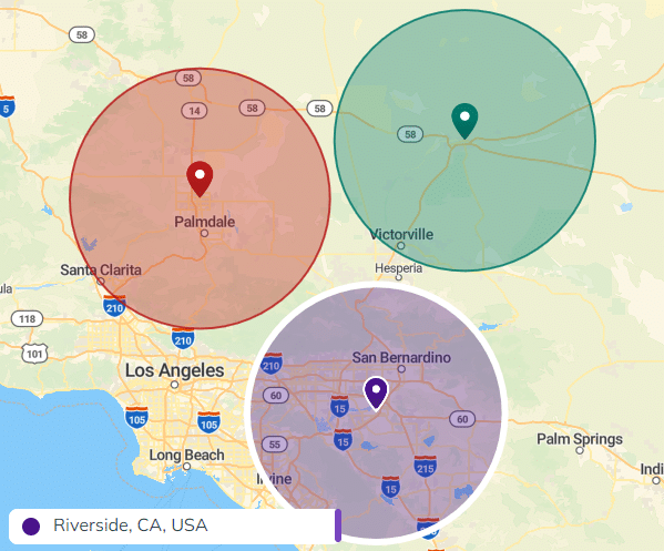
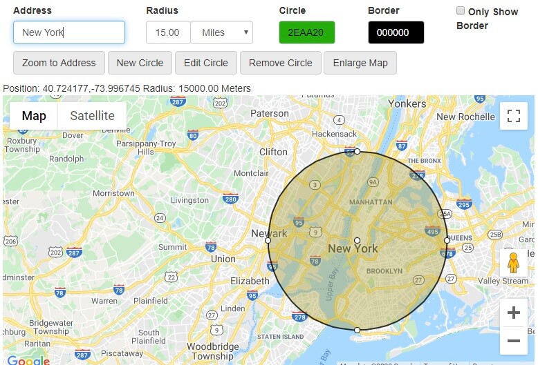
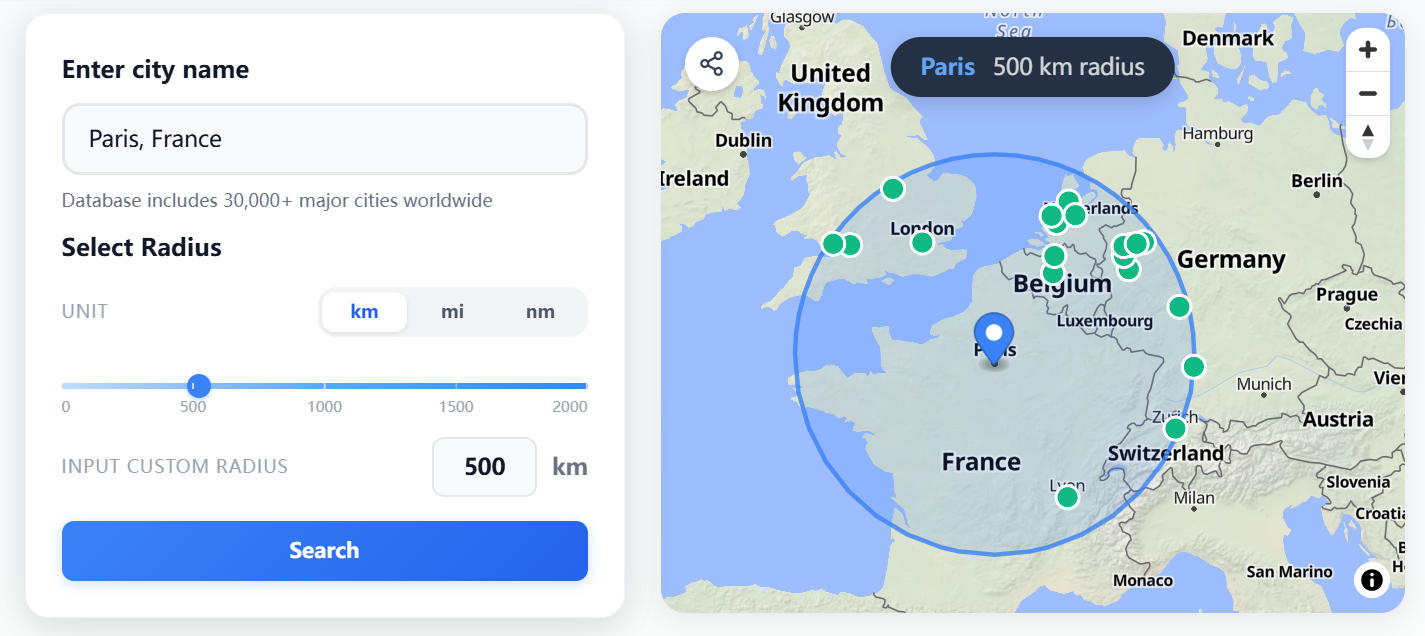
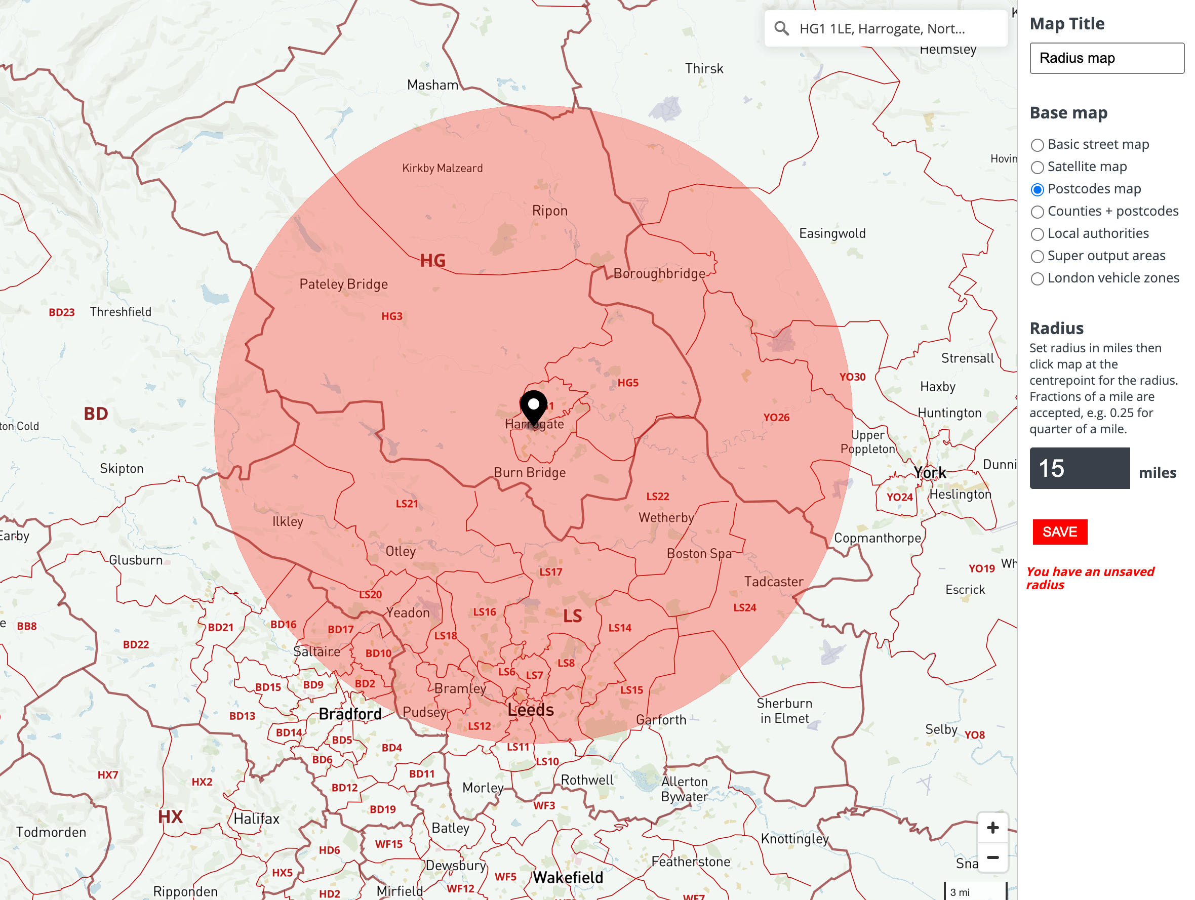
To draw a radius on a map, use an online radius calculator tool. First, navigate to a website like FreeMapTools or Map Developers. Enter a specific address or pinpoint a location on the map to serve as your center. Then, input the desired radius distance, for example, five miles or ten kilometers. The tool will automatically generate a circular boundary on the map, visually representing that exact radius from your chosen point.
What is a geographic radius?
A geographic radius defines a circular area around a central point on the Earth's surface. It measures the straight-line distance from that central point to any edge of the circle. This concept is crucial for understanding proximity, service areas, and search zones. Geographic radii are often used in urban planning, real estate, logistics, and marketing to visualize and analyze spatial relationships accurately.
Can Google Maps show a radius?
While Google Maps does not have a native feature to draw a radius circle directly, you can use third-party online tools that integrate with Google Maps data. Websites like FreeMapTools or Map Developers allow you to place a pin on a Google Map interface, specify a distance, and then display the calculated radius. Alternatively, you can use the built-in measurement tool in Google Maps to approximate distances manually from a central point.
Why do businesses use map radius tools?
Businesses use map radius tools to define their service areas, optimize delivery zones, and target local marketing efforts effectively. By visualizing their operational reach, companies can make informed decisions about customer acquisition, resource allocation, and logistical planning. This helps in understanding market density, setting competitive pricing for local services, and responding efficiently to 'near me' customer searches, boosting local presence.
How accurate are map radius calculations?
The accuracy of map radius calculations largely depends on the tool and the underlying mapping data used. Most reputable online radius calculators are quite accurate for general use, especially for straight-line distances over relatively flat terrain. For very precise measurements over long distances or complex topography, professional GIS geographic information system software may offer greater accuracy by accounting for Earth's curvature and elevation changes. Always consider the tool's source.
What are common units for measuring map radius?
Common units for measuring map radius include miles and kilometers. In the United States, miles are predominantly used for everyday applications, such as defining delivery zones or searching for locations within a certain distance. Kilometers are more common in other parts of the world and for scientific or international contexts. Most online radius tools allow users to select their preferred unit of measurement, ensuring flexibility and relevance to specific needs.
What is Map Radius Distance and How Can You Use It Effectively?Understanding map radius distance is a vital skill for many individuals and businesses across the United States. It involves measuring a precise circular area around a central point on a map. This concept is more than just a theoretical measurement; it offers practical applications for daily planning, strategic business decisions, and even personal navigation. Knowing how to define and visualize these areas can save time and resources, providing clarity for various tasks in 2026.
From determining how far a delivery service can reach to locating homes within a specific school district, the utility of a map radius is extensive. Modern online tools have made this once complex calculation accessible to everyone, transforming how we interact with geographical data. This article will guide you through the process, explore common uses, and highlight the best resources available to leverage map radius distances effectively.
For anyone needing to understand geographical reach, whether for finding local services or optimizing operational logistics, mastering the map radius concept is a significant advantage. It ensures that your plans are grounded in accurate spatial information, leading to better outcomes for your personal or professional endeavors.
How Do You Calculate Map Radius Distance?
Calculating a map radius distance typically involves using specialized online tools designed for this purpose. These platforms allow you to pinpoint a central location and then specify a desired radius in units such as miles or kilometers. The tool then visually displays a perfect circle on the map, illustrating the exact area covered within that set distance from your chosen point. This eliminates the need for manual calculations, which can be prone to errors and consume considerable time.
Most radius calculators provide a user-friendly interface. You simply enter an address or coordinates for your starting point. Next, you input the desired distance for your radius. With a click, the map updates, showing a clear circular boundary. Some advanced tools might also offer options to adjust for different geographical projections, though for most everyday uses, standard calculations suffice. Always double-check the units you are using to ensure accuracy.
Understanding how to operate these tools is a fundamental step toward utilizing map radius distance effectively. It allows for quick visualization of service areas, potential travel zones, or search perimeters, making it an indispensable resource for both personal and business planning. The convenience and precision offered by these digital tools far surpass traditional methods of estimation.
What Tools Can Help You Find Map Radius Distance?
Many online tools and applications are available to help you calculate and visualize map radius distances. Popular choices include dedicated radius map generators, which are straightforward and free to use. Websites like FreeMapTools, CalcMaps, and Map Developers offer intuitive interfaces where you can drop a pin or enter an address to define your center point, then specify the radius in miles or kilometers.
While Google Maps itself does not have a direct 'draw radius' feature, you can approximate it by using measurement tools or third-party add-ons. Many standalone radius tools integrate with Google Maps data to provide accurate visuals. For more advanced analytical needs, Geographical Information System GIS software such as ArcGIS or QGIS can perform complex radius analysis, though these are typically used by professionals for in-depth spatial planning and research.
Choosing the right tool depends on your specific needs. For quick, simple radius visualizations for personal planning or small business operations, the free online radius calculators are often the best choice. For businesses requiring precise service area definitions or complex market analysis, considering a more robust GIS solution might be beneficial.
Why Is Map Radius Important for Businesses in the U.S.?
For businesses operating in the United States, understanding map radius is critically important for strategic planning and operational efficiency. It directly impacts how a company defines its market, manages logistics, and targets potential customers. A clear understanding of geographical reach ensures resources are allocated effectively, helping businesses grow and serve their communities better.
Defining Your Service Area
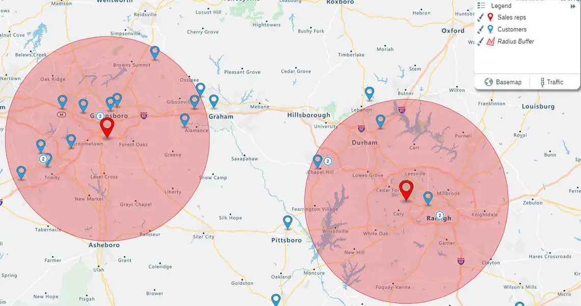
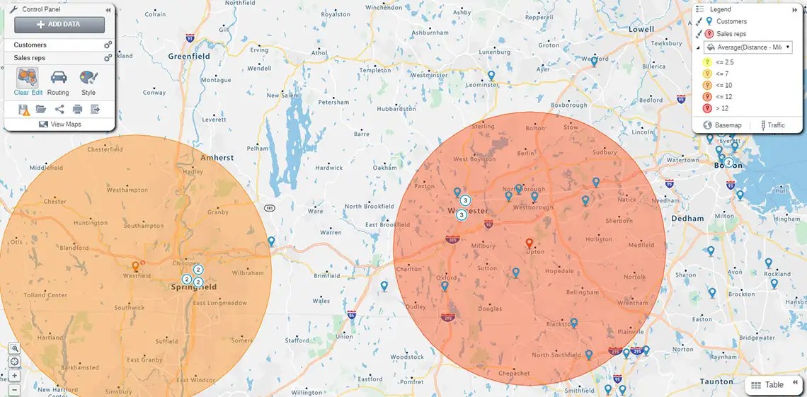
One primary use for map radius is to precisely define a business's service area. This is essential for local delivery services, home repair companies, or any business that operates within a specific geographical boundary. By drawing a radius around their central location, businesses can clearly communicate to customers exactly where they offer services. This prevents confusion, sets clear expectations, and helps optimize routing for staff.
For instance, a pizzeria can determine its delivery zone by setting a five-mile radius from its restaurant. This clear boundary helps manage delivery times and operational costs. Similarly, a plumbing service might define its primary service radius, and then charge a travel fee for locations just outside that zone. This clarity assists customers searching for
calculate map radius, how to draw a circle on a map, map distance calculator tool, what is a map radius, define service area on map, local delivery radius benefits, real estate radius search, best map radius tools, understand geographical reach, plan events with radius


Fuel Efficient Route Planning On Google Maps Guide 2026 Draw Radius On Google Maps Scaled.webp. Us Map Distance Radius . How To Draw A Radius Circle On A Map Public. Driving Radius Map How To Create A Radius Map Maptive Radius . Radius Map Free Tool For Drawing Distance Driving Time Radius Map


How To Plot A Radius On A Map Really Easily Using Our Point And Click Radius Map In Area Of Greater London 1024x720 . How To Make A Distance Radius Map Blog 06 . Driving Radius Map How To Create A Radius Map Maptive Radius Map.webp. How To Draw A Radius On A Map Draw Radius On Map Map Circle Radius Google Maps Distance Radius 3 . Free Radius Map Tool Find Cities By Distance City Distance Radius Visualizer


How To Make A Distance Radius Map Blog Public. Draw A Radius Map Step By Step ESpatial Radius Geo Map . Radius Map Map Radius . Radius Maps P2 . Membership Screenshot 2024 11 19 At 15 43 43 Map Radius Calculator


Circle With A Radius Of 2026 Circle With A Radius Of 2026 . How To Draw A Radius On A Map Draw Radius On Map Map Circle Radius Radius Around Map Point Address2 . How To Make A Distance Radius Map Blog Public. Radius Map Tool Draw A Radius On A Map Maptive Mapping Radius 590x374 2 480x304 . Create A Radius Search From The Map Flexmls Platform By FBS Image 15 317x700


Regional For 2026 Page 2 SASS Wire SASS Wire Forum. Map Radius Calculator Map Radius . Radius Map Tool Maptitude Radius Mapping Xradius Map Choropleth . Radius Eroute 2026 Update Tutorial Radius E Route . Radius Maps Software Map Radius Xmaptitude Map Radius Calculator Radius Map Example


Radius Map Tool Draw A Radius On A Map Maptive Radius Map Covid 19 590x374 2 . Us Map Distance Radius How To Draw Create A Radius On Google Maps Google Maps Distance Radius 1 . Draw A Radius On A Map Radius Tool Maptive 08 Radius Tool Large . 2026 World Map A Stylized World Map Video Overlaid With 1000 F 1755037871 . The Ultimate Risk Map Of 2026 SAFETURE Riskmap 2026 EN 1024x724


The 5 Best Tools For Drawing Radius Maps Smappen Traveltime . Radius 250 2026 January March 2026 Exhibition Artspace Radius250 Circle Type . How To Make A Distance Radius Map Blog Public. Us Map Distance Radius How To Draw Create A Radius On Google Maps Public. How To Draw A Radius Map Steps And Helpful Tips ESpatial 20 Radius Map.webp